The Hiwwelweg Neuborn is a hiking trail just outside Wörrstadt, a small town south of Mainz, the regional capital of the state of Rhineland-Palatinate in Germany. It is one of nine “Hiwweltouren” that the Rheinhessen tourist agency established to promote the region1.
It also happens to be right in my backyard.

The shock and anger over not being able to fly out into the Himalayas in March 2020 was gnawing on me. My mind was set on hiking, and the stay at home order had tied me down. I went out walking in the fields and vineyards behind my parents’ house a lot to try and calm me down. It was the first or second week of the lockdown and the air was starting to get really clear from all the cars not driving and the factories being shut down. As I reached the top of the hill overlooking the neighbouring villages, being able to see all the way to the Taunus mountains on the other side of the Rhine river at least 50 kilometers away, I realized that I had never appreciated the spectacular views and nature that was just outside my door. So as soon as I got back, I sat down and started looking into nearby hikes that wouldn’t see a lot of traffic and were thus safe to go on.
As it turned out, there was a nice medium length trail right nearby, the Hiwwelweg Neuborn.

General information
If you’re wondering about the weird name, don’t worry: it sounds weird in German, too.
The word “Hiwwel” is local dialect for “Hügel”, or the English “hill”.
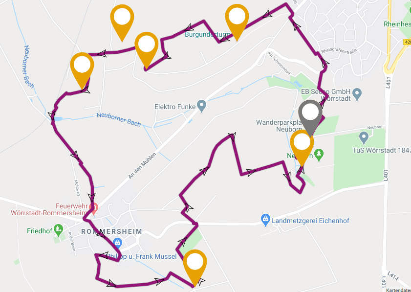
| Trail type: | Circular |
| Distance: | 8 kilometers (about 5 miles) |
| Difficulty: | easy+ (some hills, uneven terrain) |
Some tips
- If it rains in the days before you plan on going parts of the path will be muddy and slippery, especially when going downhill. Make sure you are wearing sturdy shoes.
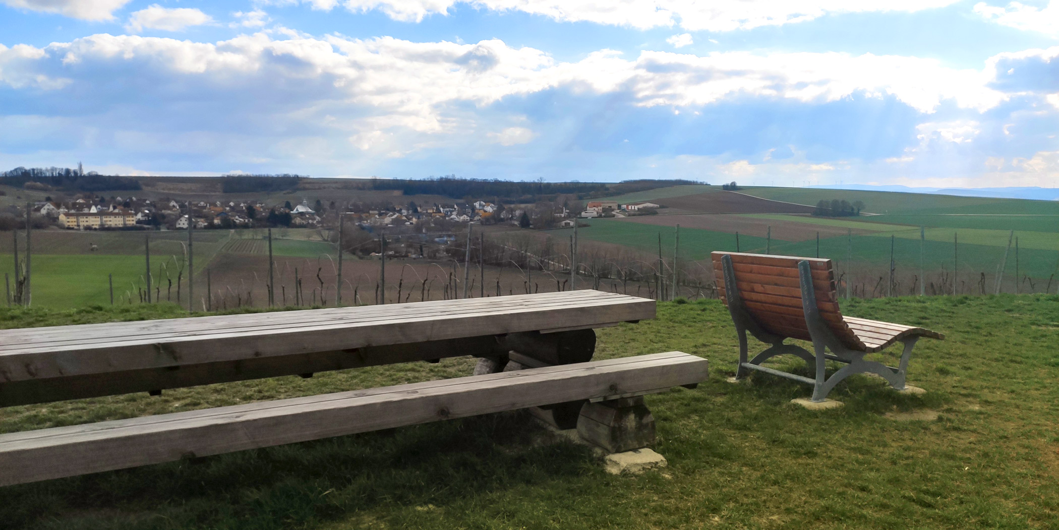
- The trail takes about 2.5h-3h to hike, depending on how fast you go and how many breaks you take. There are some nice rest areas with great views on the way, so I recommend planning for a picnic.
- If you like GPS guidance, I have found the trail in the app outdooractive (“HIW 9: Hiwweltour Neuborn”). I could not find it on komoot, but it does have all the major sights marked.
- And as always: don’t forget water and sunscreen
The trail
When I hike this trail, I start on the town exit of the road leading down into Rommersheim – the same trail start you would take if you arrived by train (see the “Getting there” section at the end).
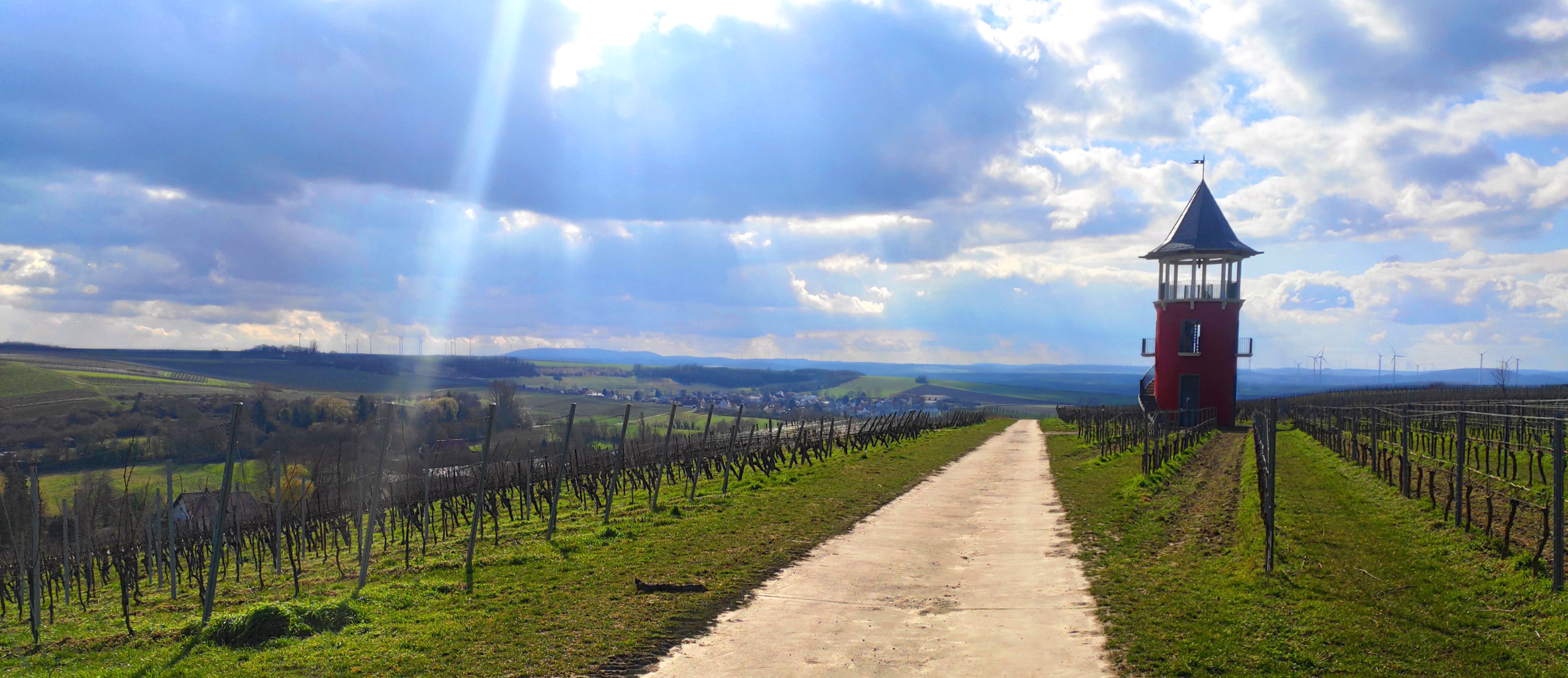
The advantage is that you start out with one of the most epic views: the Burgunderturm – named after the partner region of Burgundy.

It’s not particularly old or significant or anything, but it has a pretty spectacular view from the top.
From there the trail is extremely well marked. Look for white “h” signs with blue and green labelled “hiwweltour neuborn”.
The trail leads back and forth through the vineyards, past a viewpoint called “Schöne Aussicht” (“beautiful view”) towards the first rest stop Greifenberg where, by the way, there is also a schöne Aussicht.
As you descend further, you pass through a small copse. Here it can be muddy, so hold on to some branches.
After this you will be walking past some garden lots and… an emu farm.
From here you can already see the village of Rommersheim. Part of the trail (which isn’t really a trail at this point) leads straight through the streets, past the church and the town hall which radiate quaint village charm.
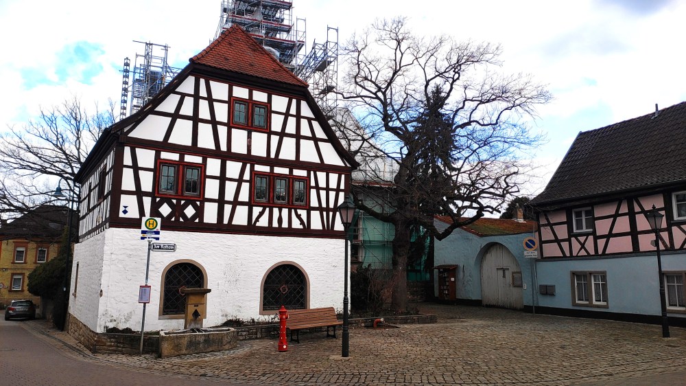
Rathaus Rommersheim 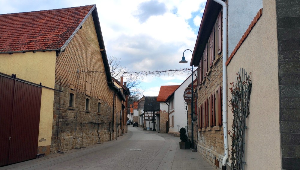
Picturesque streets of Rommersheim village center
You leave Rommersheim behind and head into the vineyards again, up the hill and to another rest area called Lorlenberg. From here you can look back down into Rommersheim and can see all the way to the start of the trail with the Burgunderturm in the distance.
Shortly after this rest stop comes a special treat: the trail intersects with the Camino de Santiago (“Jakobsweg” in German), the stretch that leads from Aachen to Worms, at the Rommersheimer Steinkreuz.
After passing through some more fields, the trail now leads down into the Neuborn forest – it’s called a forest, but honestly, it’s quite small, it’s not like you can get lost in it or anything – where you can have a rest at the Waldgaststätte which by the way means forest pub (once they are allowed to open again ofc). The path from here leads up to the parking lot, where you would start the trail if you arrived by car (see “Getting there” section below). At the parking lot you can find another information board with details about the hike.
The final section, or first section if you parked here, leads back up to the Wörrstadt town exit, giving you one last look over the sweeping Rheinhessen vineyards.
Getting there
By car
Since the trail is circular you can start it at any point like the center of Rommersheim or the town exit Wörrstadt just above the Neubornbad outdoor swimming pool. However parking is easiest in the Neuborn recreational area since there is a proper and free (at time of writing) parking lot. You can reach the car park coming from the Autobahn:
- From the A63 exit Wörrstadt, following the signs towards Wörrstadt.
- When you reach the town, do NOT turn right but instead follow the bypass for approximately 1 km where it splits into a sharp turn right (leading back into the town you just passed), and a left turn continuing on the bypass.
- Take the left and after another 300 m turn right into the Neuborn area (which is signed at this point).
- Follow the road to the parking lot.
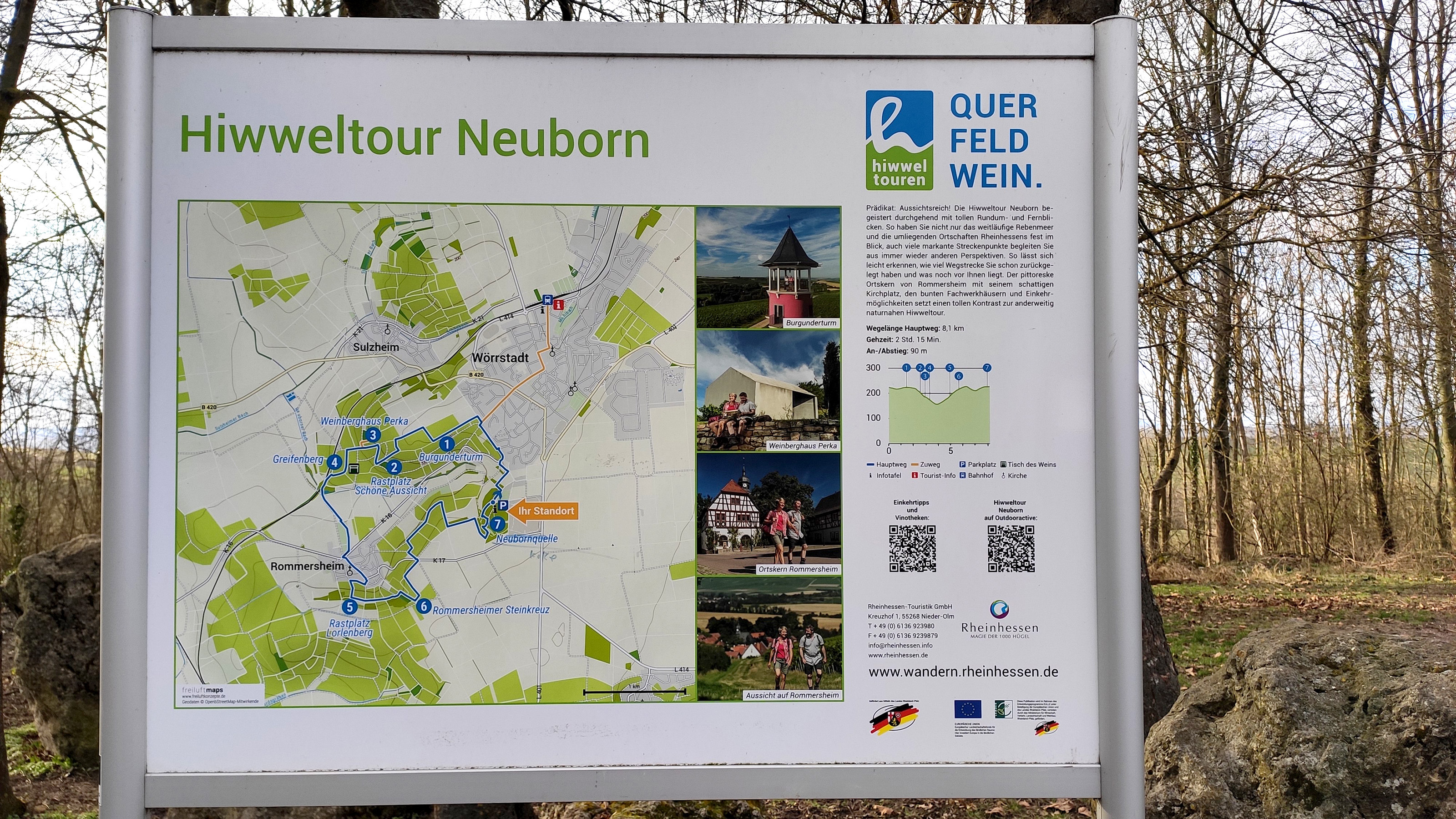
There is a detailed information board at the parking lot showing the full route and highlights.
There is also some parking on the walk up from the train station (see “By train” directions below) and you can also just find a spot on the road near the town exit and walk the rest.
By train
There are direct trains connecting to Wörrstadt from Mainz and Alzey.

When you exit the train station and cross the road you will find a board with details about the Hiwwelweg routes and how to get there.
The walk to the trail adds another 1.5 km but it’s through the town, so it’s all asphalt and easy to walk. The walk up trail is also marked with orange “h” signs labelled “Zuweg” (German for “walk up trail”).
- From the train station exit turn right and walk up the hill to the roundabout.
- On the roundabout turn left (you should be walking past the Rewe on your left)
- Follow the road for about 500m – at this point the road makes a right turn where cars aren’t allowed to continue on straight anymore (the straight road turns into an oncoming one-way street)
- Follow the right turn until you reach the town exit sign (another 800m, you should come across an intersection with traffic lights roughly in the middle of that stretch)
- The trail starts right there, you should already see the Burgunderturm up ahead.

One Comment Add yours