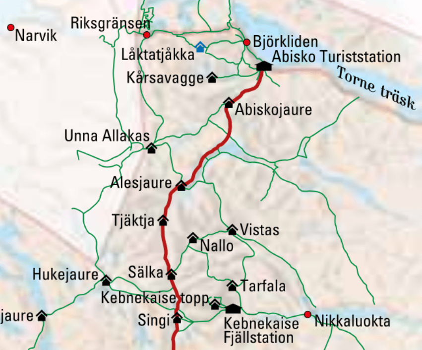
Kungsleden – The King’s Path – is one of Sweden’s most famous long-distance hikes. The roughly 400 km long trail from Abisko in the North to Hemavan in the South can be hiked in whole or in sections, the most popular being the northernmost 105 km long section leading from Abisko to Nikkaluokta, passing by Sweden’s highest mountain: Kebnekaise (2099 meters).
In July, when all of Sweden is on vacation, the trail is bustling with hikers from all walks of life, pun intended. But there is more than enough space to go around and while in some places it can feel busy, it never feels crowded – unless we are talking about Kebnekaise Fjällstation, a popular one-day trip from Kiruna.
Some general tips:
- The trail is extremely well marked. While we carried a map and compass we didn’t need it.
- The trail is neither very high nor very difficult, although you need to have proper hiking shoes since you will be balancing on rocks a lot.
- Also be prepared to wade!
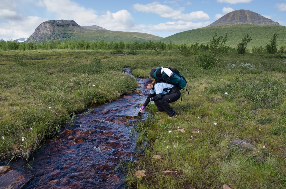
- You never need to carry a lot of water. There are plenty of streams and the water is so clean, you can drink it without purifying.
- We only carried food for around 3 days – every manned “stuga” on the way sells supplies, so you can easily stock up on the way.
Pro-tip: Never hike Kungsleden without proper raingear!
Arrival Day – Abisko Turiststation to Abisko National Park Campground
Distance hiked today: 7 km
Distance hiked total: 7 km
Distance to go: 98 km
Getting into Abisko is a bit of a trek in and of itself. Most visitor will fly into Kiruna which is Sweden’s most northern city and host to the largest and most modern underground iron ore mine in the world¹. Depending on which way you want to hike the trail, South to North or North to South, you can either catch a bus to Nikkaluokta or take the afternoon train to Abisko. There are also (night) trains from Narvik (Norway), Luleå and Stockholm that go directly to Abisko.
The train actually stops right outside the trail head (Abisko Turiststation); don’t get off too early (Abisko Östra station) which is the station for the village itself.
For the arrival day, given that it was fairly late already, we decided to just head into the Abisko National Park area to find a place to sleep.
Note: Sweden has the “Allemansrätten” which Wikipedia translates as “everyman’s right” – a law that allows you to camp anywhere in nature as long as you are out of sight of any houses. National Parks are the exception to this rule, where you are only allowed to camp in designated areas. The Abisko National Park camp site is roughly 7-8 km from the trail head.
Day 1 – Abisko National Park Campground to past Abiskojaure
Distance hiked today: 13 km
Distance hiked total: 20 km
Distance to go: 85 km
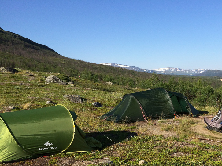
The stretch between Abiskojaure and Alesjaure is the only section where water becomes sparse for a few hours. So we decided to set up camp just before heading into the hillside leading up to Alesjaure. It turned out that sunlight around midnight meant our tents got a lot warmer than anticipated.
Day 2 – Past Abiskojaure to Alesjaure
Distance hiked today: 17 km
Distance hiked total: 37 km
Distance to go: 68 km
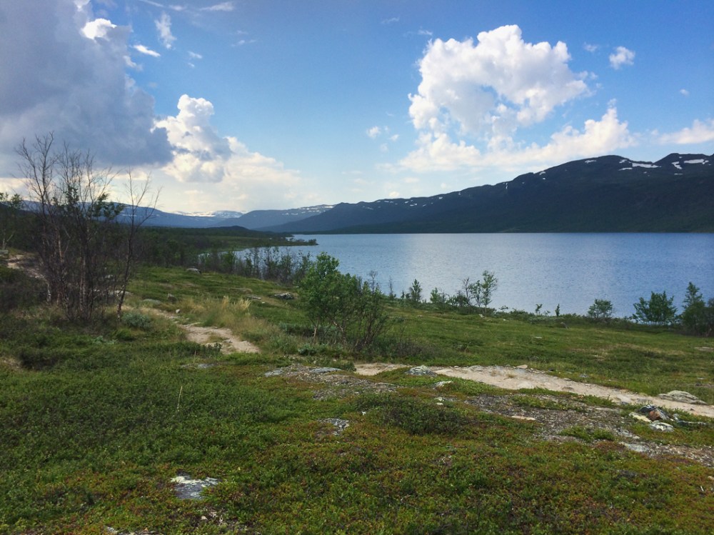
Until you reach the lake at Alesjaure, make sure to fill your water bottles. While all other sections of this hike will have little streams left and right, this stretch will be dry.
Once we reached the lake we cheated a little and took the boat across, so we didn’t actually hike the full stretch. We bought some snacks in the Alesjaure station and carried on another kilometer or so to pitch our tent.

Day 3 – Alesjaure to Sälka (Tjäkta pass: 1150 meters)
Distance hiked today: 23 km
Distance hiked total: 60 km
Distance to go: 45 km
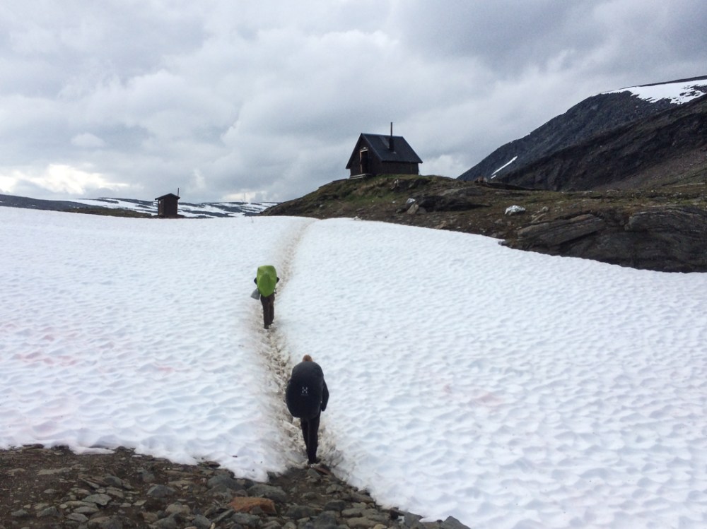
Since all the guide books were selling Tjäkta pass as the highest and most difficult part of the journey, we were a little over-prepared. While Tjäkta does indeed make you hike uphill for a little bit, it was by far not the crazy climb we were expecting, so we actually managed to get quite a bit further today than we intended. Expect snow around the pass, even in the middle of July.
The more difficult part of this section came when we reached a larger stream that we could not find a way around. So off came boots and pants and into the freezing glacial water. Keeping your socks on helps with traction in the water!
There are a few unmanned huts on the way that provide shelter and welcome warmth and offered some proper tables for cooking lunch.
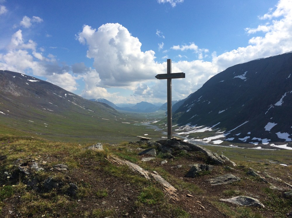
The views over Tjäkta are amazing and we were lucky with the weather that day. It only started pouring down just as we reached Sälka, but by then we were masters of pitching the tent and had everything in the dry within minutes. It helps that Sälka stuga has a sauna!
Day 4 – Sälka to Singi
Distance hiked today: 12 km
Distance hiked total: 72 km
Distance to go: 33 km
With the previous day’s increased mileage we could take it slow from here on out. We decided not to go all the way down to Singi stuga, but instead cut over a side path towards Kebnekaise, saving ourselves a couple of kilometers. That night we had a proper thunderstorm. It was loud and scary!

Day 5 – Singi to Kebnekaise
Distance hiked today: 14 km
Distance hiked total: 86 km
Distance to go: 19 km
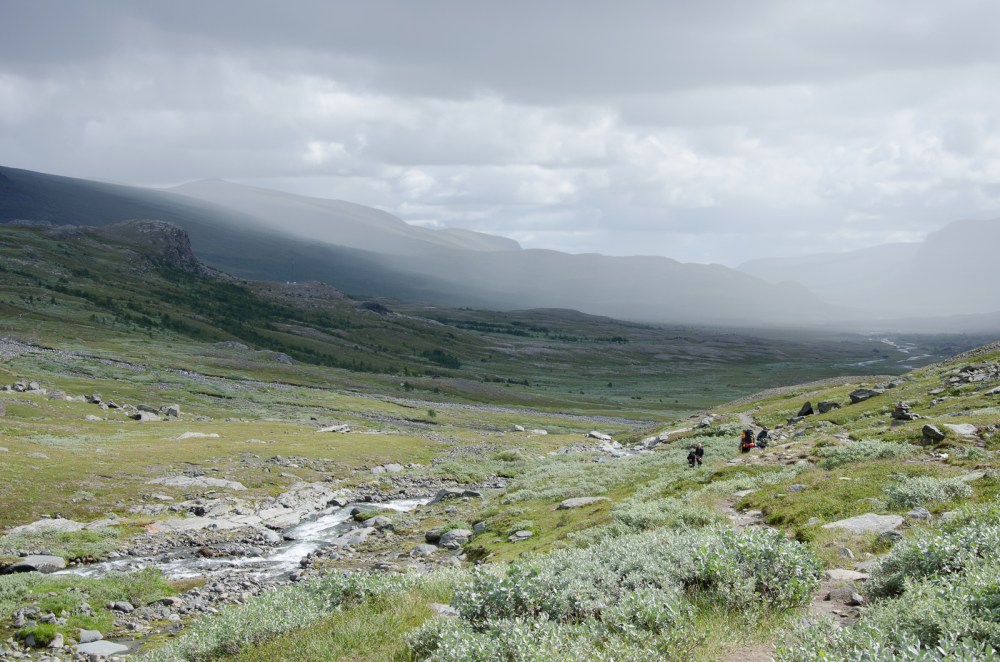
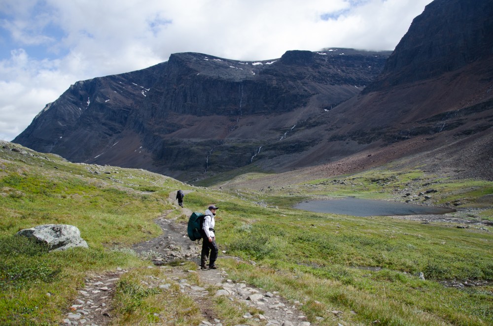
This stretch is my least favourite. It is rocky and not very scenic (well, in comparison) and don’t expect to find a place to pitch your tent here. However, it is made up for by dramatic vistas and beautiful greenery once you leave the mountains behind and start approaching Kebnekaise.
Pro-tip: Don’t camp directly next to the Fjällstation, since almost everyone does that. Yes, it’s convenient (Hot showers! Proper toilets! Fresh food!) but it also makes for noisy neighbours.

Day 6 – Kebnekaise to Nikkaluokta
Distance hiked today: 18 km
Distance hiked total: 104 km
Distance to go: 1 km
The final stretch of this section where once again you can take a shortcut by boat over the water. Make sure to stop by LapDonald’s near the eastern boat landing and snack on some Reindeer Burger and waffles with heavy cream and cloudberry jam! We didn’t walk all the way back to Nikkaluokta but stayed a little further out to enjoy the last bits of nature on our final night.

Day 7 – Nikkaluokta to Kiruna
Distance hiked today: 1 km
Distance hiked total: 105 km
Distance to go: 0 km
The bus to Kiruna leaves Nikkaluokta around 8h in the morning. But with sunlight 24/7 it wasn’t a problem getting up early. While there is another bus in the afternoon, nothing could keep us from our hotel room and a soft bed for longer than necessary.

2 Comments Add yours